Candler Park is a large residential neighborhood developed primarily in the late 19th and early 20th centuries. It was founded as Edgewood, a small suburban community in DeKalb County halfway between Atlanta and Decatur.
Early History
DeKalb County was formed in 1822 after the Indian Springs Treaty of 1821 forced Creek and Cherokee Indians from the area and opened it up for settlement. Decatur was established as the county seat in 1823, and Atlanta was established in 1837 as “Terminus,” marking the southern end of the Western & Atlantic Railroad. In 1845 another railroad, the Georgia Railroad, reached Atlanta from Augusta in the east. The Georgia Railroad followed the Native American ridge trail between Decatur and Atlanta which forms part of the Easter Sub-Continental Divide. In the Civil War, much of the Battle of Atlanta took place along this ridge and the area of Candler Park (the park) was home to a Union encampment which shows up on some later maps as “Union Square.”
Edgewood to Candler Park
The community of Edgewood grew up in the 1870s and included today’s neighborhoods of Edgewood south of the railroad and Candler Park on the north side with the railroad itself as a central feature rather than a dividing line. The Georgia Railroad stopped then at “Mayson’s Crossing” which was a small commercial district about where the Edgewood-Candler Park MARTA Station is today. The Town of Edgewood was incorporated in 1898 and was autonomous for about ten years before being annexed by the City of Atlanta.
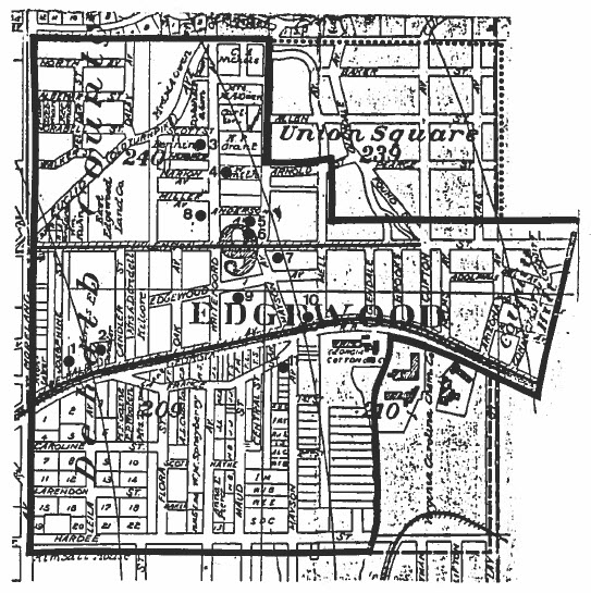
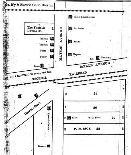
In the late 1800s, Edgewood was home to both black and white residents with little segregation, as was common in communities of that time. Substantial African American communities within today’s Candler Park neighborhood included Hooper Street, off Oakdale Road, and the Rose Hill community, centered along Candler Park Drive, both north of McLendon. According to the 1900 census, Edgewood’s population was 1,196 and included 155 white and 216 black children. As early as 1879, the African American Antioch Baptist Church congregation met in a “brush arbor” near Oakdale and Miller Ave, which, by 1883, was officially the site of the “Antioch Baptist Church of Edgewood” which later moved, building the “Old Stone Church” on Candler Park Drive around 1918. The Antioch congregation remained there until 1950.
The area of Candler Park was served by two streetcars, one along McLendon and the Atlanta–Decatur line along DeKalb Ave. The Georgia Railroad stop eventually ceased to be as streetcars took over intercity transportation. The streetcars and annexation into the City of Atlanta in 1908, spurred the rapid development of the neighborhood as a middle class suburban neighborhood. Realty companies and large property owners began to subdivide the area and sell off great numbers of small lots and the McLendon commercial districts at Oakdale and Clifton—streetcar stops—were developed in the 1920s. In 1927 the Mary Lin School was built to replace the old Edgewood Public School, which was where Iverson Park is now. During this time, newly developed lots were restricted to white ownership through deed restrictions, although the existing African American communities remained embedded in the neighborhood until 1942 (Rose Hill) and even into the 1980s (Hooper Ave).
After the creation of Candler Park in 1922 and its golf course in 1928, the neighborhood increasingly came to be called Candler Park.
Like many other intown Atlanta neighborhoods, beginning in the 1950s the Candler Park neighborhood saw changes related to “white flight.” Disinvestment in the neighborhood meant that some homes were divided into duplexes for supplementary and rental income, a change that remains evident in a few houses today. But the neighborhood, predominately white to begin with, became even more white as the Edgewood neighborhood to our south became increasingly black. The Antioch East Baptist Church moved to Edgewood in 1950, Hooper Street became increasingly white, and the good citizens on Whitefoord Avenue—a street that spanned Edgewood and Candler Park, south to north—realizing that they now shared their street name with black families to the south, requested a name change in 1960 to Oakdale Road, a street that before had began in Druid Hills and extended north.
1970s to Today
The more recent history of our neighborhood has its roots—like so much else in Atlanta—not in the railroad this time but in THE ROAD, the issue that probably more than any other has shaped our neighborhood as we know it today.
Proposed roads that would cut through established, leafy neighborhoods prompted considerable community organizing in the 1970s and profoundly affected city politics from the mayor on down, beginning with the election of Maynard Jackson in 1973. First was the proposed I-485 that would cut east through the Old Fourth Ward and then north through Virginia Highland, Morningside, and other neighborhoods. Next was the Stone Mountain Freeway, that would extend east from I-485 through Inman Park, Candler Park, and Druid Hills. The clover leaf that would have been their intersection is now the site of the Carter Center, but that’s another story.
Many neighbors still remember the fight to save our historic neighborhoods and the two organizations formed to oppose the DOT road planners. CAUTION, Inc, primarily a collection of respectable lawyers working the system, and the “Roadbusters,” the less respectable, more rabble-rousing element, worked together to ultimately defeat the proposed highways, but only after large swaths of land had been cleared. (Watch this video showing the Roadbusters at work).
The matter was finally settled in the 1990s. Today what would have been I-485 now loops by the Carter Center, ends at Ponce de Leon, and is named the John Lewis Freedom Parkway. What would have been the Stone Mountain Freeway is now a path and Freedom Park. And thank CAUTION, Roadbusters, and others that we don’t live in the shadow of a bustling, busy highway instead of the shade of Freedom Park.
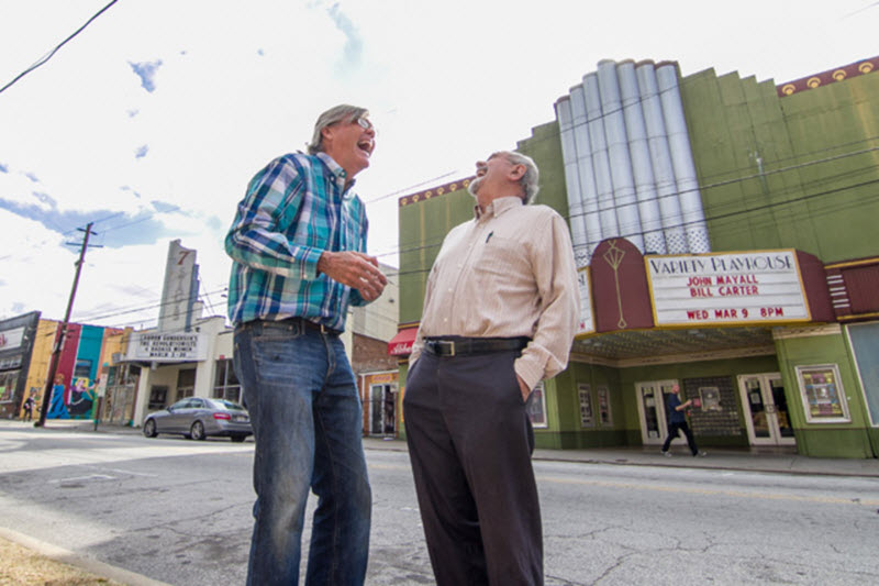
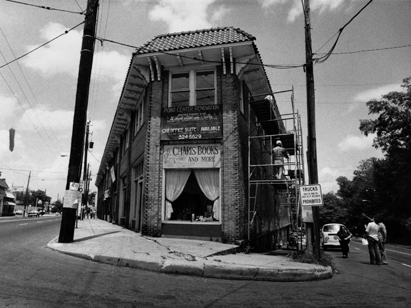
The 1970s and 1980s saw many other changes in Candler Park, among them the revitalization of Little Five Points and the formation of community organizations like the member-owned BOND Community Credit Union and the Candler Park Neighborhood Organization. Without activists like Kelly Jordan and Don Bender the two active theaters in Little Five would be parking lots and the eclectic collection of shops both along Euclid and Moreland might have remained abandoned and in disrepair—as detailed in a Creative Loafing article from 2016, How Little Five Point Got Weird. Today the Little Five Points Alliance continues to work to connect commercial property owners, businesses, and residents with everyone who loves Little 5 Points.
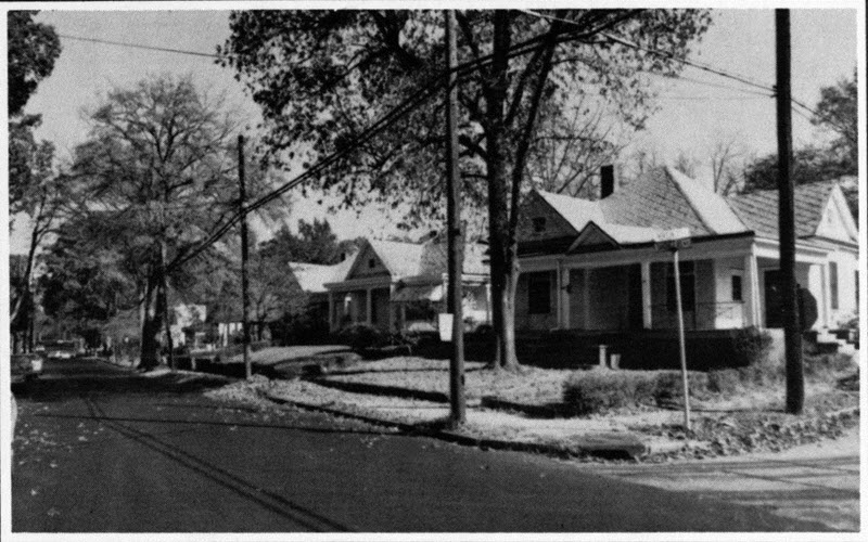
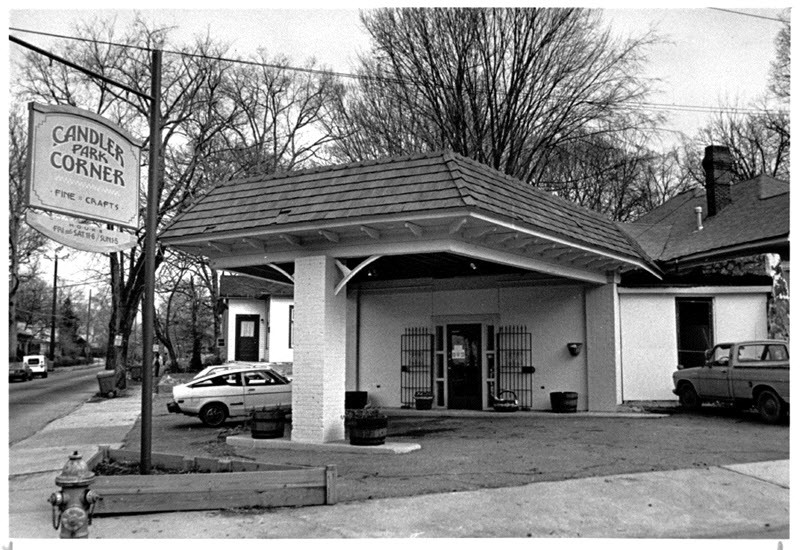
Candler Park has cultivated a certain reputation for eccentricity. Here’s a YouTube video worth watching, Candler Park: A Neighborhood in Transition, produced by Georgia State University’s Department of Anthropology in 1980 and containing interviews with Candler Park residents old and new.
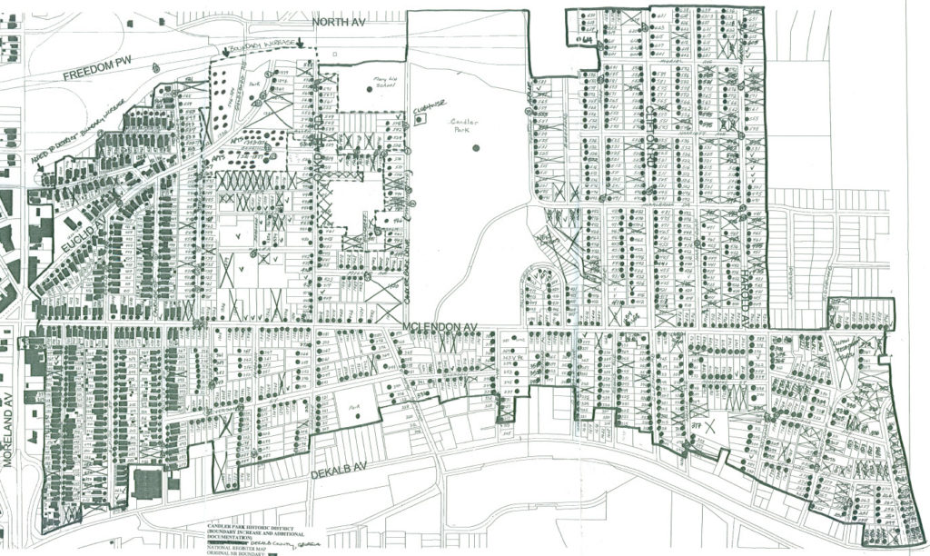
Candler Park was listed on the National Register of Historic Places in 1983 (updated in 2005) as the Candler Park Historic District (2005 map below, 1983 map here), not to be confused with local City of Atlanta Historic or Landmark District designation, which includes design review by the Urban Design Commission. National Register listing simply means that Candler Park appears on the “official list of the Nation’s historic places worthy of preservation.” Previously, the Smith-Benning house (at the corner of Oakdale and Benning Place) had been individually listed on the National Register in 1982.
But what does National Register listing mean? Robert Craig, architectural historian and owner of the Smith-Benning house explains: “National Register listing prevents certain federal action (like federal roads being built thru the neighborhood) without economic impact review and public comment although the famous ‘presidential parkway road fight’ demonstrated that this process of stopping such intrusions is not easy and is often nonproductive with respect to historic preservation, AND the road fight and such causes are costly since vested interests with big bucks usually prevail. But were it not for this effort by your neighbors, an eight lane expressway (four lanes each way) would be today crossing Moreland Avenue via an overpass, and Olmsted’s Druid Hills parkway system and community would be fatally compromised.” For further information see the Georgia State Historic Preservation Department’s page on the National Register of Historic Places.
Architectural Development
Most houses in Candler Park Park are detached single-family dwellings, although there are also early 20th century multi-family dwellings and larger apartment complexes dating to the mid-20th century. Craftsman bungalows from the 1910s–1930s dominate much of the neighborhood along with a number of other architectural types and styles including the earlier Queen Anne and Folk Victorian one- and two-story houses, American Four-Square houses, and American Small Houses from the 1940s (see photos in National Register nominations linked below).
A growing appreciation for the amenities of in-town living, particularly in attractive, walkable, historic neighborhoods with access to good schools, such as the Candler Park neighborhood, and changes in the housing market, have shaped residential development in the area. The mid-2000s housing boom produced a spike in the number of older homes in Candler Park being demolished and replaced by much larger, more expensive homes. The pace of infill development slowed after 2008 due to the nationwide housing bust and recession, but these development pressures are building once again.
History never ends and there are many more stories to tell—this is merely an introduction into some of the forces and issues that have shaped our ever-evolving Candler Park neighborhood.
Resources
Edgewood/Candler Park: A study of the Suburbanization Process in Atlanta, 1880–1980 — 1985 thesis by Ann Huston — detailed history of our neighborhood with many historic maps and pictures.
Early Edgewood-Candler Park BiRacial History Project’s website — history, maps, and pictures detailing the historic African American presence in the Candler Park neighborhood.
1983 National Register nomination — application including detailed descriptions of the neighborhood and 63 photographs of Candler Park houses.
updated 2005 National Register Boundary Increase — application including 50 additional photographs of Candler Park houses.
Bonded: A Brief History of the Old BOND Corporation — article by Jennifer Richardson in the October 2020 Messenger, p. 12 — history of the Bass Organization for Neighborhood Development, a precursor of CPNO, in the 1970s.
How a Tragic Fire led to the Development of Candler Park — article by Jennifer Richardson, including notes on the history of street names in Candler Park.
— Roger Bakeman and Emily Taff, June 2020; with Tom Painter, September 2020